

DOD's geospatial agency needs developers to stock its app store.
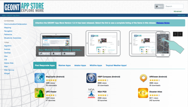 |
| The GEOINT App Store: open to select customers, with out-of-this-world data. |
The National Geospatial-Intelligence Agency (NGA) is looking for a few good apps. In an effort to make the aerial and satellite imagery and other location-based data that the agency collects more accessible to the people who need it, NGA created the GEOINT App Store. Last week, the agency released an update to the store, which is available over the Web as well as on the Department of Defense's secret and top-secret classified networks. Now, it wants more developers to provide their wares there.
Work on the store kicked off in 2010 at the behest of Director of the NGA Letitia Long, who has pushed for the geospatial software industry to take on more of the burden of application development for the NGA's customers. The hope was that the NGA could leverage the "app economy" to make it easier and cheaper to get software into the hands of its customers and push forward development of mobile applications that would be applicable to a broader audience.
The store is open to anyone with a government or military e-mail address, or anyone with a government sponsor, such as state and local law enforcement officials and emergency first responders. There are a number of applications tailored to disaster response in the store, as well as iPad apps for military pilots that give them access to flight charts and details about airstrips around the world. Other apps, available only to users of the Secret Internet Protocol Routed Network or the top-secret Joint Worldwide Intelligence Communications System network, provide higher resolution imagery and an unknown array of things to do with it.


No comments:
Post a Comment